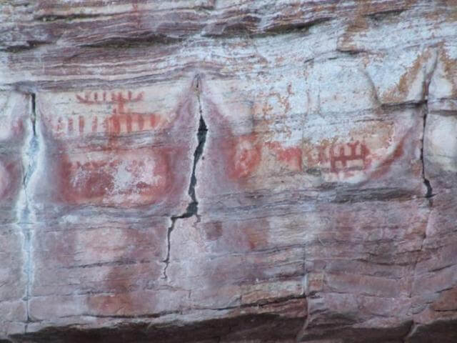
The Nipigon River Pictographs are located on cliffs in the Nipigon Bay at the mouth of the Nipigon River where it enters Lake Superior in Ontario’s Superior Country. The pictographs are only viewable by boat, canoe or kayak. There is a boat launch and EZ Dock for kayaks at the Nipigon Marina and a launch at the Red Rock Marina adjacent to the site. This Indigenous pictograph site is the second largest on Lake Superior – the first being the Agawa pictographs. The depictions are thought to be painted using red ochre mixed with sturgeon fish oil. These materials held up so well that the paintings are still visible after centuries, although no one is quite sure of their age and they have faded over years. One of the most recognizable depictions is of the Maymaygwayshi, known to a be trickster that lives in riverbanks on Lake Superior. If not respected and granted offerings of gifts they will cause bad luck for those on the water. A canoe and other symbols and lines have also been drawn here.
Nipigon River
Nipigon ON P0T2J0
Canada